One Missing Comma Nearly Gave Britain a Permanent Foothold in North America
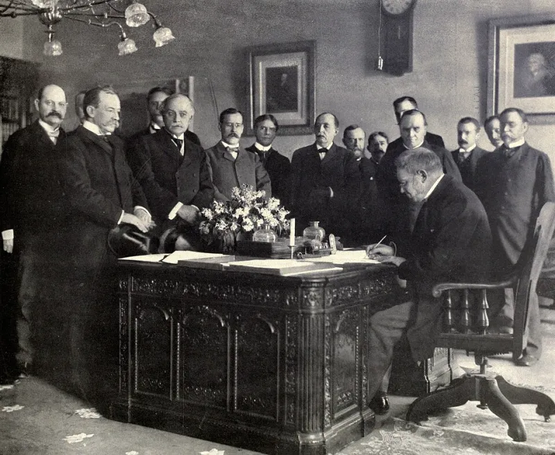
Photo: Frances Benjamin Johnston, Public domain, via Wikimedia Commons
There's a version of American history where the Revolutionary War ends, the peace treaty gets signed, and then the whole thing quietly unravels over punctuation.
It almost happened. Not metaphorically — literally. The document that ended the war and established the geographic boundaries of the United States contained language so ambiguous, so poorly punctuated, and so open to competing interpretations that the argument over what it actually meant continued for decades after the ink dried. Borders shifted. Fishing rights were disputed. Diplomatic crises erupted. And at the center of several of those crises was the question of what a particular phrase, with or without a comma, actually obligated either side to do.
We talk about punctuation like it's a minor thing — the kind of detail that only English teachers and copy editors lose sleep over. But in legal and diplomatic documents, punctuation isn't decoration. It's architecture. And in the late 18th and early 19th centuries, that architecture was being built by exhausted diplomats working in longhand, under political pressure, in a second language (for some of them), with no standardized rules about how commas and semicolons were supposed to function.
The results were, to put it gently, a mess.
The Document That Was Supposed to Settle Everything
The Treaty of Paris, signed in September 1783, was negotiated primarily by Benjamin Franklin, John Adams, and John Jay on the American side, with British representatives led by David Hartley. The goal was straightforward in concept: end the war, establish American sovereignty, define the borders of the new nation, and work out the practical details of what happened to loyalists, debts, and various commercial arrangements.
In practice, it was one of the most consequential pieces of diplomatic drafting in American history — and it was done under significant time pressure, with imperfect maps, incomplete geographic knowledge of the territory being divided, and the inherent slipperiness of 18th-century legal English.
The boundary provisions in particular were a problem. The treaty attempted to describe the northern border of the United States using rivers, lakes, and geographic features — many of which were either poorly mapped or described in language vague enough to support multiple readings. The phrase "due north" appears in the boundary description of what is now Maine and New Brunswick, and the question of exactly where "due north" led when measured from a particular point became the subject of a boundary dispute that simmered for nearly sixty years.
The Line That Moved Depending on How You Read It
The northeastern boundary dispute — sometimes called the Aroostook Controversy, after the river at its center — is one of the most sustained punctuation and language arguments in American diplomatic history. The treaty described the boundary using a series of rivers and highlands, but the phrase "highlands which divide those rivers that empty themselves into the river St. Lawrence from those which fall into the Atlantic Ocean" turned out to be almost useless as a geographic description.
The highlands in question didn't form a clean, identifiable ridge. Depending on which survey you trusted and how you parsed the phrase, the boundary could be drawn in radically different places — with the difference amounting to thousands of square miles of territory that both the United States and Britain (through its Canadian provinces) wanted for its timber, its river access, and its strategic value.
British and American negotiators spent the better part of six decades arguing about what the treaty meant. The ambiguity wasn't accidental, exactly — the negotiators in 1783 knew the maps were inadequate — but the language they chose to paper over that inadequacy was so loosely constructed that it created more problems than it solved.
The Aroostook War of 1838-1839 — a confrontation between American settlers and Canadian lumberjacks that escalated to the point of militia deployments on both sides — was, at its root, a consequence of a poorly worded treaty. Nobody fired a shot (the conflict is sometimes called the "Bloodless War"), but the standoff was real, and it took the Webster-Ashburton Treaty of 1842 to finally draw a line both sides would accept.
The Fishing Rights Fiasco
The northeastern border wasn't the only place where ambiguous treaty language caused lasting trouble. The fishing rights provisions of the 1783 treaty were another site of prolonged argument — and here, the problem was less about geography than about the precise meaning of specific words.
The treaty distinguished between American "rights" to fish in British-controlled waters and American "liberties" to fish in those same waters. These sound like synonyms. They are not. A right, in legal language, is something that cannot be unilaterally revoked. A liberty is something granted at the discretion of the granting party — something that can be withdrawn.
British negotiators eventually argued that the War of 1812 had terminated the "liberties" granted in 1783, since those liberties were part of a peace settlement that a subsequent war had effectively nullified. American negotiators disagreed. The argument went on for decades and required additional treaty-making to resolve — or attempt to resolve, since the fishing rights disputes in the North Atlantic kept resurfacing well into the 20th century.
The word choice in 1783 — "rights" in some places, "liberties" in others — may have been deliberate hedging, or it may have been careless drafting. Either way, it cost both countries significant diplomatic energy and, for American fishing communities in New England, had real economic consequences.
Why Punctuation Fights Are Never Really About Punctuation
It's tempting to read these disputes as evidence that 18th-century diplomats were sloppy. Some of them were. But the deeper explanation is that ambiguous language in treaties is often a feature, not a bug.
When two parties can't agree on something, one solution is to write the disputed item in language vague enough that both sides can read it as a victory. The ambiguity is the compromise. The problem is that the ambiguity doesn't disappear — it just gets deferred to the next generation of negotiators, lawyers, and, occasionally, militia commanders.
This pattern didn't end with the 18th century. Legal scholars and historians have documented similar dynamics in the Treaty of Guadalupe Hidalgo (1848), which ended the Mexican-American War and contained boundary descriptions that required decades of additional survey work and negotiation to implement. The language of the treaty was clear enough to end the war. It was not clear enough to actually draw the line.
The Marks That Built the Map
America's borders — the lines on the map that feel fixed and permanent — are, in many places, the residue of arguments about words and punctuation that most people have completely forgotten. The shape of Maine is partly a consequence of how a phrase in an 18th-century treaty was interpreted. The fishing rights of New England communities were affected for generations by the difference between two near-synonyms.
The next time you agonize over where to put a comma in an email, remember: you're working in a tradition with genuinely high stakes. The marks are small. The consequences aren't.